Showcasing Urban Trees for Environmental Education with IoT Technology. SUTEE is an ERASMUS+ Strategic Cooperation Partnership in the field of school education project.
Using AI for potential zoning maps
On
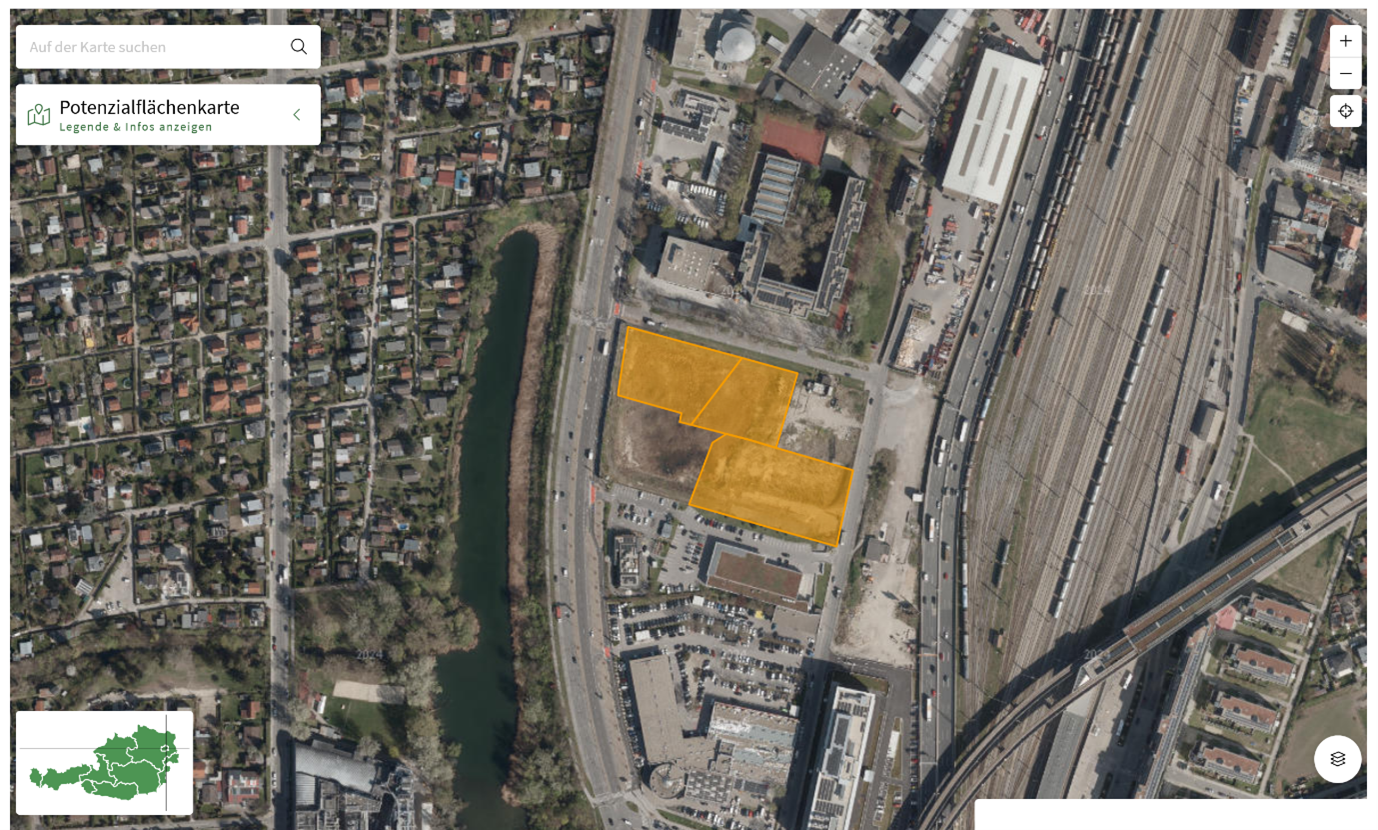
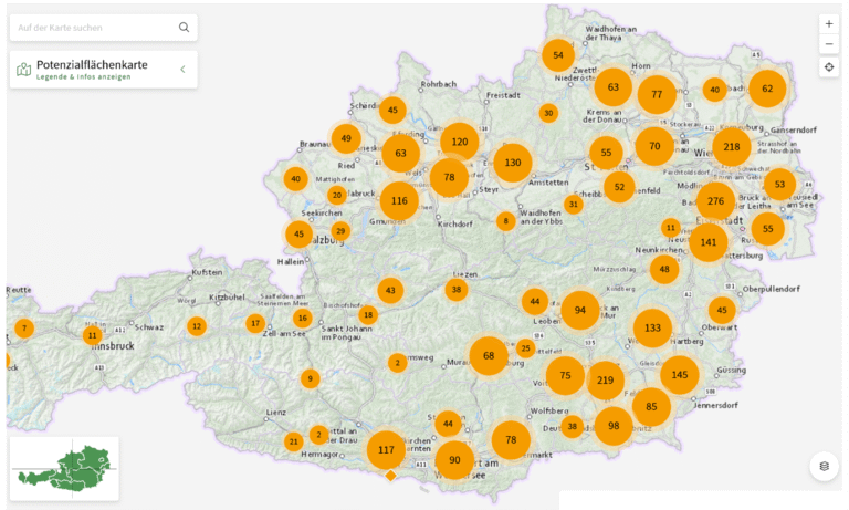
The Austrian Ministry of Agriculture and Climate has released a nationwide potential map. Using AI analyses from aerial images, Geodata, and satellite imagery, previous industrial or commercial fallow land that is no longer in use has been identified and mapped.
Figure 1. Potential zoning map for Austria
These spaces offer unused spatial reserves for planning and growth. They provide potential re-development opportunities without the need for new land zoning, thus saving natural environments and farmland that would otherwise come into focus for further urban developments.
Figure 2. The map includes fallow lands above 1000m2
The advantage of these potential lands is that they typically already possess the infrastructure (e.g. water, sewer, gas, and electric connectivity) needed for new uses such as office buildings. This allows them to be quickly recycled without going through a lengthy official re-zoning process. While the map cannot be seen as an indicator for a trend to less construction work and more re-naturalisation of precious soil, it is a potential sign to be economical and efficient with the available space, avoid sealing of natural environments and recycle rather than re-zone our lands.